15 Fascinating Facts About The Vietnam Map
Vietnam is located in Southeast Asia; it is known as the easternmost country on the Indochinese peninsula. Having the shape of the letter S, Vietnam has a long coast along the South China Sea, offering beautiful Vietnamese beaches. Here is a list of 15 fascinating facts about the Vietnam map that you need to know.
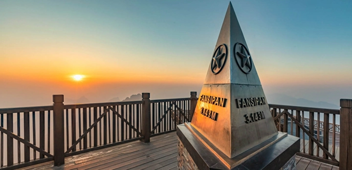
#1 Fansipan Peak
The highest mountain peak is Fansipan, located in the northwest of Vietnam and also of the whole Indochina. Fansipan is sometimes dubbed the “Roof of Indochina,” filled with a cornucopia of floral and faunal varieties and species.
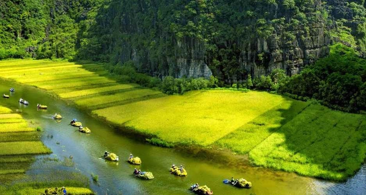
#2 Mekong Delta Map
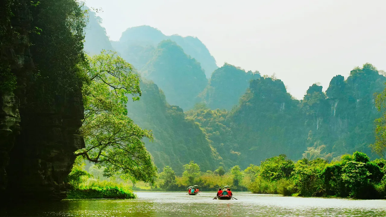
The capital of Vietnam is Hanoi. This is the second largest city of Vietnam; it lies on the bank of the Red river Delta and is an old city. Up until now Hanoi has lasted for more than 1000 years.
#3 Mekong River Delta vs. Red River Delta: Which Is Bigger?
The area of the Mekong River Delta is almost three times larger than the area of the Red River Delta. However, the Red River Delta is surrounded by more urban provinces than the Mekong River Delta.

#4 Seasons In Vietnam
Northern Vietnam provinces have four-season weather, whereas Southern Vietnam provinces only experience two: rainy season and dry season. Furthermore, in more southern provinces. On your Vietnam tours you will have to deal with the weather in Vietnam; it is just so unexpected. However, I’m sure this is definitely a fun experience, right?
#5 Ho Chi Minh City
The biggest city of Vietnam is Ho Chi Minh City. This is the most important commercial and industrial center of Vietnam.

#6 Administrative System Of Vietnam
There are 64 provinces and cities in the administrative system of Vietnam. Among which Hanoi, Ho Chi Minh City, Hai Phong, Danang, and Can Tho are the main cities.
#7 Mekong River vs. Red River: Which Is Longer?
The length of the Red River in Vietnam is two times longer than that of the Mekong River in Vietnam. However, when it comes to the total length of the two rivers, the Mekong River beats the Red River ruthlessly.

#8 Hue City
Due to the geographic location, Hue experiences the highest rain level in comparison with that of Hanoi and Ho Chi Minh City.
#9 Railroads In Vietnam
The length of the road connecting Hanoi and Ho Chi Minh City is 1738 kilometers.

#10 "Neighbors" of Vietnam
Vietnam is adjacent to China, Cambodia, and Laos. When it comes to the sea, it is contiguous to that of the Philippines, Malaysia, China, Singapore, and Indonesia.
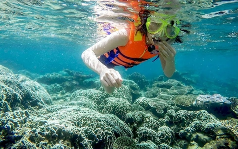
#11 The Area of Vietnam Sea
The area of the Vietnam sea is 1,000,000 km², with the coastline's length approximately 3000km.

#12 Coffee Industry
The central highlands abound in a type of dirt called "bazan," suitable for growing industrial trees such as tea, coffee beans, and cacao.
#13 Vietnam Does Have Snow
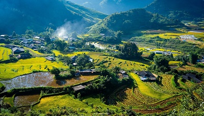
Vietnam does have snow in the winter, in highlands such as Sapa, located in northwestern Vietnam. This explains the vast increase in tourists traveling to the highlands of Vietnam these recent years.
#14 Vietnam Does Have Coal
Most coal mines are located in Northern and Central Vietnam. Thus has been establishing mining industries in these areas.
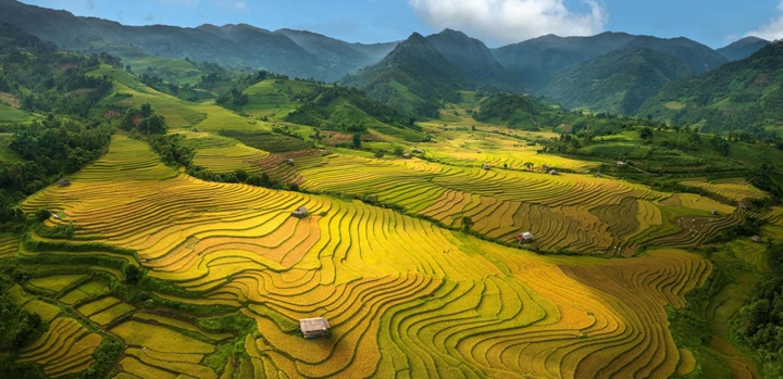
#15 Mountains Area in Vietnam
Mountains and highlands take up three-fourths of the total area of Vietnam. Which means these places have always been offering spectacular and ideal places for you to go on your Vietnam tours.
>>> "A new pedestrian area" around Hoan Kiem Lake
>>> Vietnamese New Year Traditions: Meaningful Customs During Tet Holiday
Giang is a Vietnam destination expert with over a decade of experience guiding travelers through the country’s most inspiring regions. Born and raised in the Red River Delta, Giang has an intimate understanding of local traditions, cuisine, and culture. Her articles reflect her mission: to help travelers discover the authentic Vietnam — beyond the postcards — through meaningful encounters and immersive journeys.
Send us your comments about : 15 Fascinating Facts About The Vietnam Map
Required fields *
You may also like

You may also like

Your complete 2026 guide to traveling from Greece to Vietnam—covering visas, flights, best times to visit, and insider tips to help you plan a smooth and unforgettable journey.

Discover Vietnam in October: weather insights, best places to visit, seasonal highlights, and expert travel tips to help you plan an unforgettable journey across the country.

Is Vietnam in August worth it? Discover where to go, weather insights, green rice season, and expert tips to travel smart and enjoy the country despite the rainy season.
Recent comments
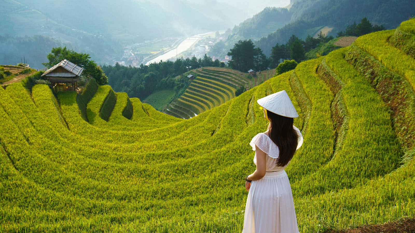
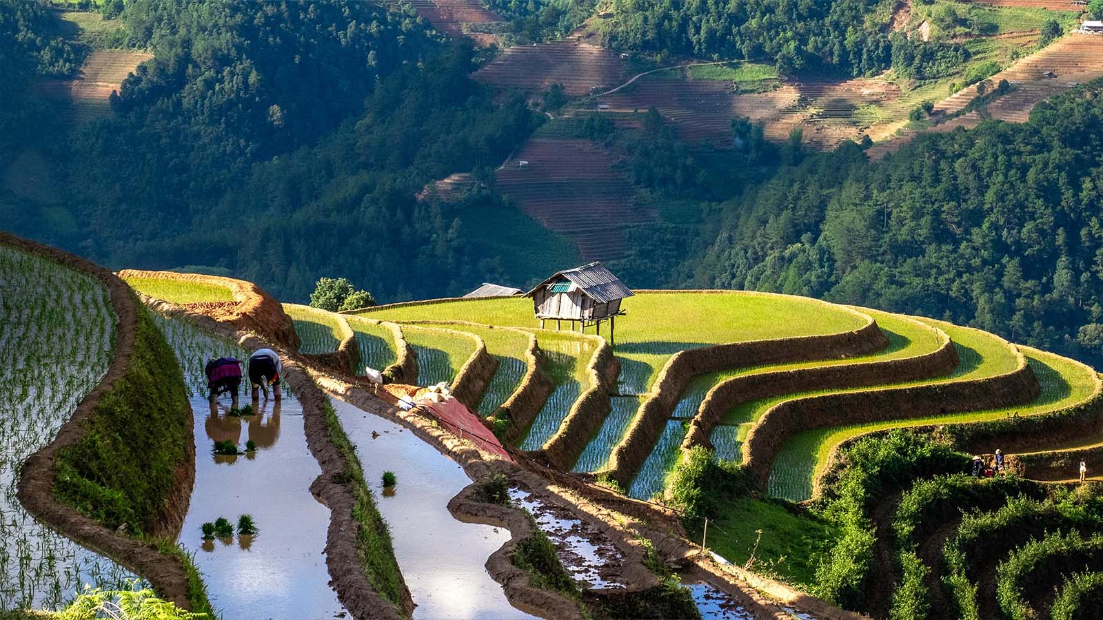
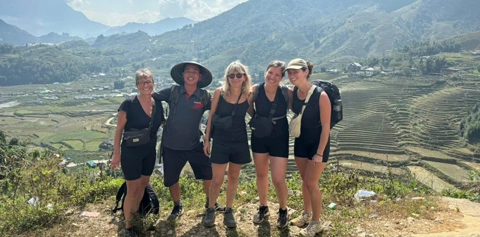
Four travel friends — three ladies and one gentleman — dreamed of discovering Sapa, its legendary terraced rice fields, and especially of reaching the summit of Mount Fansipan. Thanks to the ultra-modern cable car, we were able to reach the 3,143-meter peak without too much effort.
We loved exploring the vast fields and dragon fruit plantations.

Hiking through vast terraced rice fields, jungle trails, and steep climbs that sometimes tested our endurance…
You might also be interested

Master basic Vietnamese greetings with this quick guide. Learn how to say hello and thank you politely in both formal and casual settings, making your conversations smoother.
Experience authentic Vietnam by staying in local homestays, where you share daily life, enjoy homemade meals, and support communities while connecting with warm families and cultural traditions.
This practical guide helps German travelers plan a smooth trip to Vietnam with clear info on flights, visa rules, health tips, and cultural dos and don’ts for a smooth trip.

Vietnam’s cultural symbols—from the lotus to the conical hat—carry deep meanings and traditions. This guide explains how they reflect the nation’s identity and remain essential today.

Find halal food easily in Vietnam with this guide to Muslim-friendly restaurants across Hanoi, Ho Chi Minh City, Da Nang, and other major destinations for a worry-free meal.

Traveling Vietnam for 7 days? This budget guide breaks down daily costs, suggested cash amounts, and smart spending tips to help you manage your money comfortably throughout the trip.
Avoid customs issues by knowing what you cannot bring back from Vietnam. This guide outlines prohibited items, key regulations, and tips for choosing safe, compliant souvenirs.

Flying or overlanding to Vietnam from Thailand? This guide compares routes, border crossings, visa requirements, and transport options to help you choose the most efficient way to travel.

UK travelers planning a Vietnam trip will find essential advice here, from flight options and visa rules to accommodation tips and arrival expectations for a smooth and enjoyable journey.

Traveling to Vietnam with kids? This guide highlights 10 family-friendly activities, from workshops and water puppets to safe beaches and cultural games, ensuring a fun trip for all ages.

Find the best gifts to bring home from Vietnam, from coffee and snacks to traditional crafts. This guide highlights top souvenirs for foreigners and key items to avoid at customs.

Discover how Vietnamese women dress across generations and regions, from the graceful ao dai to modern streetwear, revealing a vibrant blend of tradition, identity, and evolving style.
Our clients’ favorite journeys to customize
Looking for inspiration? Discover some of our most popular tours in Vietnam, highly appreciated by our travelers. They are a great starting point to help you choose the perfect journey through Vietnam, Laos, Cambodia, Myanmar, or Thailand—whether you’re traveling solo, as a couple, with family, or with friends.
And since this is your trip, feel free to customize it just the way you like!
Vietnam Cambodia Itinerary 14 Days
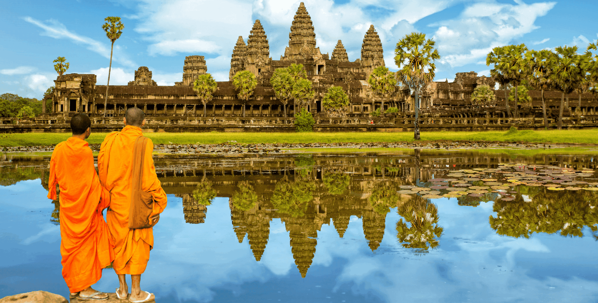
Hanoi – Hoa Binh – Mai Chau – Ninh Binh – Halong bay – Hue - Danang – Hoian – Saigon – Ben Tre - Can Tho – Saigon - Siem Reap Angkor - Tonlé Sap - Siem Reap – Ta Prohm - Departure

Vietnam and Laos 14 days
Saigon - My Tho - Da Nang- Hoian – Hue - Hanoi - Halong Bay - Vientiane Luang Prabang - Pak Ou – Khuang Si - Luang Prabang – Departure

Honeymoon Tour Packages In Vietnam 12 Days
Saigon Arrival - City Tour – Mekong Delta – Danang – Hoian - by flight - Da Nang – Hanoi - by flight – Halong - overnight on junk – Departure

Authentic Hoang Su Phi Trekking Tours
Hoang Su Phi trekking tours take you to stunning terraces, meet few tourists, connect with locals and enjoy authentic culture.

The Best of Ha Giang Trekking Tours
Discover Ha Giang on trekking tours where you live local life, enjoy breathtaking views and escape the crowded routes.
Vietnam Itinerary 2 Weeks
Hanoi - Ninh Binh - Lao Cai - Sapa - Muong Hum market - Ha Long Bay - Hue - Danang - Hoi An - Saigon - Mekong Delta - Cai Rang floating market - Departure
Are you interested in this tour?

Our testimonials
Tailor-made trips to Vietnam

Don't miss anything from Southeast Asia
The press talks about us


Comment